10. 1762 Arakan earthquake
 |
| 1762 Arakan earthquake |
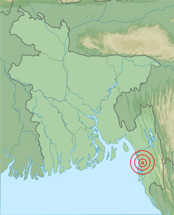
The 1762 Arakan earthquake occurred at about 17:00 local time on 2 April, with an epicentre somewhere on the coast from Chittagong (modern Bangladesh) t Arakan in modern Burma. It had an estimated magnitude of as high as 8.8 on the moment magnitude scale. It triggered a local tsunami in the Bay of Bengal and caused at least 200 deaths. The eastern part of Bangladesh and the southwestern part of Burma lie along the highly oblique convergent boundary between the Indian Plate and the Eurasian Plate. The earthquake lasted for about four minutes at Chittagong. A tsunami was reported along the northeastern coast of the Bay of Bengal and at Dhaka and Kolkata. This is regarded as a local tsunami, as no effects were recorded on the western side of the bay.
Short Overview
Date: 2 April 1762
Magnitude: 8.8 Moment Magnitude Scale
Location: Chittagong, Bangladesh
Areas affected: Bangladesh
Casualties:
200 Deaths
9. 1611 Sanriku Earthquake
 |
| 1611 Sanriku Earthquake |
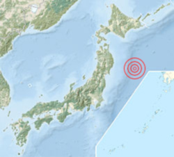
The 1611 Sanriku earthquake occurred on December 2, 1611 with an epicenter off the Sanriku coast in Iwate Prefectur. The magnitude of the earthquake was 8.1 on the moment magnitude scale. It triggered a devastating tsunami. A description of this event in an
official diary from 1612 is probably the first recorded use of the term
'tsunami. The tsunami reached its maximum estimated height of about 20 meters. According to old documents, 1,783 people were killed in the Sendai Domain, and over 3000 horses and men in the Nanbu and Tsugaru domains.
Short Overview
Date:
December 2, 1611
Magnitude: 8.9 Moment Magnitude Scale
Location: Pacific Ocean, Hokkaido, Japan
Areas affected: Japan
Casualties: 5000 Deaths
8. 869 Sanriku Earthquake
The 869 Sanriku earthquake and associated tsunami struck the area around Sendai in the northern part of Honshu on 9 July 869. The earthquake had an estimated magnitude of at least 8.4 on the moment magnitude scale, but may have been as high as 9.0, similar to the 2011 Tōhoku earthquake and tsunami. In Japan this earthquake is commonly called "Jogan Jishin. In the area which the earthquake struck, the Imperial Court of Japan battled with an indigenous people of the Tōhoku region, Emishi, at that time. According to Nihon Sandai Jitsuroku, around 1000 people were killed by the tsunami.
Short Overview
Date: 9 July 869
Magnitude: 8.4-9.0 Moment Magnitude Scale
Location: Pacific Ocean, Tōhoku region, Japan
Areas affected: Japan
Casualties: 1000 Deaths
7. 1700 Cascadia Earthquake
 |
| 1700 Cascadia Earthquake |
The 1700 Cascadia earthquake occurred along the Cascadia subduction zone on January 26 with an estimated moment magnitude of 8.7–9.2. The megathrust earthquake involved the Juan de Fuca Plate that underlies the Pacific Ocean, from mid-Vancouver Island in British Columbia, Canada, south along the Pacific Northwest coast as far as northern California. The length of the fault rupture was about 1,000 kilometers (620 miles) with an average slip of 20 meters. The earthquake caused a tsunami that struck the coast of Japan. Evidence supporting the occurrence of the 1700 earthquake has been gathered into the 2005 book The Orphan Tsunami of 1700, by Brian Atwater, Kenji Satake, David Yamaguchi, and others.
Short Overview
Date: 26 January 1700
Magnitude: 8.7-9.2 Moment Magnitude Scale
Location: Cascadia subduction zone, Japan
Areas affected: Japan
6. 1868 Arica Earthquake
 |
| 1700-Cascadia-earthquake |
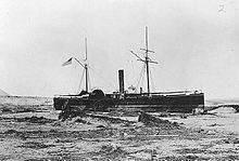
The 1868 Arica earthquake occurred on 13 August 1868, near Arica, then part of Peru, now part of Chile, at 21:30 UTC. It had an estimated magnitude between 8.5 and 9.0. A tsunami (or multiple tsunamis) in the Pacific Ocean was produced by the earthquake, which was recorded in Hawaii, Japan, Australia, and New Zealand. The earthquake caused almost complete destruction in the southern part of Peru, including Arica, Tacna, Moquegua, Mollendo, Ilo, Iquique, Torata and Arequipa, resulting in an estimated 25,000 casualties. The tsunami caused considerable damage in Hawaii, washing out a bridge along the Waiohi river. About 400 aftershocks were recorded by 25 August of that year.Contemporary accounts say that the earthquake shaking lasted somewhere between five to ten minutes.
Short Overview
Date: 13 August 1868
Magnitude: 8.5-9.0 Moment Magnitude Scale
Location: Arica, Chile (then Peru)
Areas affected: Peru and parts of what is now northern Chile
Casualties: 25,000+ Deaths
5. Kamchatka earthquakes
 |
| Kamchatka earthquakes |
Three earthquakes, which occurred off the coast of Kamchatka Peninsula in far eastern Russia and the Soviet Union in 1737, 1923 and 1952, were megathrust earthquakes and caused tsunamis. There are many more earthquakes and tsunamis originating from Kamchatka, of which the most recent was the 1997 Kamchatka earthquake and tsunami originating near the Kronotsky Peninsula. The main earthquake struck at 16:58 GMT (04:58 local time) on November 4, 1952. Initially assigned a magnitude of 8.2, the quake was revised to 9.0 magnitude moment scale in later years. A large tsunami resulted, causing destruction and loss of life around the Kamchatka peninsula and the Kuril Islands. Hawaii was also struck, with estimated damages of up to US$1 million and livestock losses, but no human casualties were recorded.
Short Overview
Date: 4 November 1952
Magnitude: 9.0 Moment Magnitude Scale
Location: Kamchatka, Russian SFSR, Soviet Union
Areas affected: Russia, Japan, New-Zealand, Alaska, Chile
Casualties: US$1 million, No Deaths
4. 2011 Tōhoku Earthquake
 |
| 2011 Tōhoku Earthquake |
The 2011 earthquake off the Pacific coast of Tōhoku was a magnitude 9.0 undersea megathrust earthquake off the coast of Japan that occurred at 14:46 JST (05:46 UTC) on Friday 11 March 2011. The earthquake is also often referred to in Japan as the Great East Japan earthquake and also known as the 2011 Tohoku earthquake, and the 3.11 earthquake. It was the most powerful earthquake ever recorded to have hit Japan, and the fourth most powerful earthquake in the world since modern record-keeping began in 1900. On 10 March 2015, a Japanese National Police Agency report confirmed 15,891 deaths, 6,152 injured, and 2,584 people missing across twenty prefectures, as well as 228,863 people living away from their home in either temporary housing or due to permanent relocation.
Short Overview
Date: 11 March 2011
Magnitude: 9.0 Moment Magnitude Scale
Aftershocks: 11450
Location: Pacific Ocean, Tōhoku region, Japan
Areas affected: Japan, Pacific Rim
3. 2004 Indian Ocean earthquake
 |
| 2004 Indian Ocean earthquake |
The 2004 Indian Ocean earthquake occurred at 00:58:53 UTC on 26 December with an epicentre off the west coast of Sumatra, Indonesia. The event is known by the scientific community as the Sumatra–Andaman earthquake. The resulting tsunami was given various names, including the 2004 Indian Ocean tsunami, South Asian tsunami, Indonesian tsunami, the Christmas tsunami and the Boxing Day tsunami. The undersea megathrust earthquake was caused when the Indian Plate was subducted by the Burma Plate and triggered a series of devastating tsunamis along the coasts of most landmasses bordering the Indian Ocean, killing 230,000 people in 14 countries. With a magnitude of Mw 9.1–9.3, it is the third-largest earthquake ever recorded on a seismograph. The earthquake had the longest duration of faulting ever observed, between 8.3 and 10 minutes. It caused the entire planet to vibrate as much as 1 centimetre (0.4 inches) and triggered other earthquakes as far away as Alaska.
Short Overview
Date: 26 December 2004
Magnitude: 9.1 Moment Magnitude Scale
Location: Indian Ocean, Sumatra, Indonesia
Areas affected: Sri Lanka, India (mostly in Tamil Nadu), Thailand, Maldives, Somalia
Casualties: At least 228,000 to 230,000 dead.
2. 1964 Alaska earthquake
 |
| 1964 Alaska earthquake |
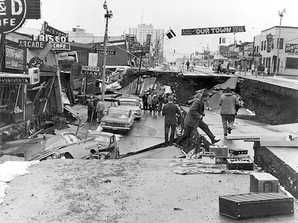
The 1964 Alaskan earthquake, also known as the Great Alaskan earthquake and Good Friday earthquake, occurred at 5:36 P.M. AST on Good Friday, March 27. Lasting four minutes and thirty-eight seconds, it was the most powerful recorded megathrust earthquake in U.S. and North American history. Two hundred miles southwest, some areas near Kodiak were permanently raised by 30 feet (9.1 m). Southeast of Anchorage, areas around the head of Turnagain Arm near Girdwood and Portage dropped as much as 8 feet (2.4 m), requiring reconstruction and fill to raise the Seward Highway above the new high tide mark. Post-quake tsunamis severely affected Whittier, Seward, Kodiak, and other Alaskan communities, as well as people and property in British Columbia, Oregon, and California. Tsunamis also caused damage in Hawaii and Japan. Evidence of motion directly related to the earthquake was reported from all over the earth.
Short Overview
Date: 27 March 1964
Magnitude: 9.3 Moment Magnitude Scale
Location: Prince William Sound, Alaska, USA
Areas affected: United States
Casualties: 139 killed
1. 1960 Valdivia earthquake
 |
| 1960 Valdivia earthquake |
The 1960 Valdivia earthquake or Great Chilean earthquake of Sunday, 22 May 1960 was the most powerful earthquake ever recorded, rating 9.5 on the moment magnitude scale. It occurred in the afternoon (19:11 GMT, 15:11 local time), and lasted approximately 10 minutes. The resulting tsunami affected southern Chile, Hawaii, Japan, the Philippines, eastern New Zealand, southeast Australia, and the Aleutian Islands. The main tsunami raced across the Pacific Ocean and devastated Hilo, Hawaii. Waves as high as 10.7 metres (35 ft) were recorded 10,000 kilometres (6,200 mi) from the epicenter, and as far away as Japan and the Philippines. the United States Geological Survey citing studies with figures of 2,231, 3,000, or 5,700 killed and another source using an estimate of 6,000 dead. Different sources have estimated the monetary cost ranged from US$400 million to 800 million (or $3.19 billion to $6.38 billion today, adjusted for inflation).
Short Overview
Date: 22 May 1960
Magnitude: 9.5 Moment Magnitude Scale
Areas affected: Chile, Argentina, United States, Japan, Philippines
Casualties: 2,230 – 6,000 killed


Post a Comment